Bolivia is one of the most amazing countries in South America, where literally every corner is a natural attraction. One of the most beautiful places in the southwestern part of the country is the National Park. Eduardo Avaroa, where impregnable mountains and green valleys, gigantic volcanoes and bizarre rock formations, boiling geysers and colorful lakes are located on an area of 715 hectares. Thousands of tourists from all over the world come to see this diverse beauty every year.
Beautiful lakes, Laguna Blanca (Spanish: Laguna Blanca – “White Lake”) and Laguna Verde (Spanish: Laguna Verde – “Green Lagoon”), are located on the picturesque Altiplano Plateau (Spanish: Altiplano Plateau) in the southwestern region Bolivia, near the border with Chile.
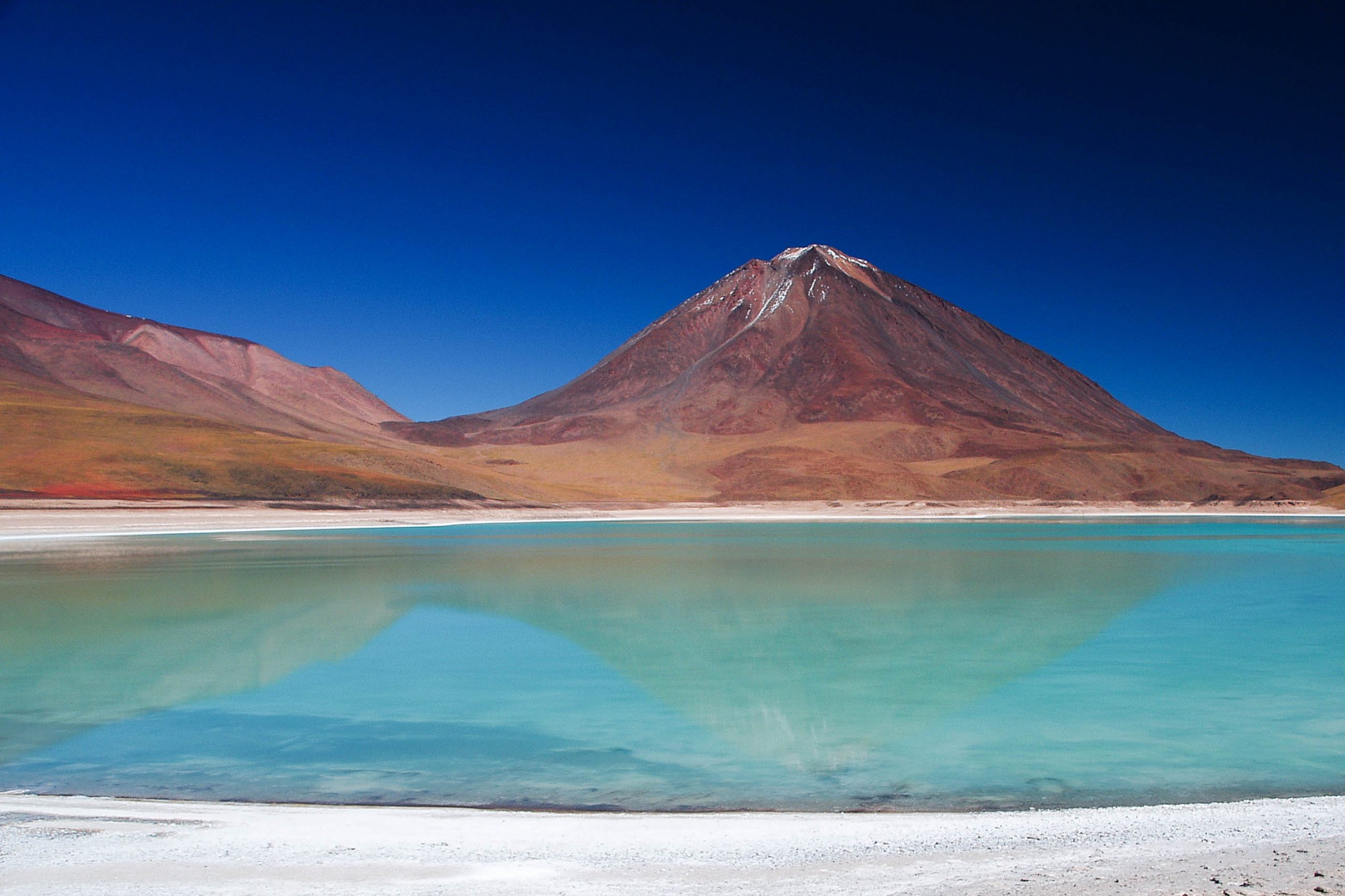
Both reservoirs are located at the foot of the dormant volcano Licancabur (Spanish: Licancabur; 6200 m above sea level) at an altitude of 4350 m above sea level and belong to the territory of the Eduardo Avaroa National Nature Reserve (Spanish: Reserva Nacional de Fauna Andina Eduardo Avaroa), Department Potosi (Spanish Provincia de Potosi). The lakes, which are separated only by a narrow isthmus 20-30 m wide, are usually considered as a single natural landmark.
Gorgeous couple
Despite the fact that the lakes are close to each other and, in addition, are connected by a narrow strait, they are completely different. Each of the reservoirs has unique features.
The parameters of the White Lake are relatively small. Its length is 5.6 km, width is 3.5 km, the area of the water surface is about 11 km². The name “Laguna Blanca” is due to the unusual whitish tint of the water. This is due to the high concentration of a special composition of minerals in the lake, due to which the water acquires a strange milky white color.
The water of the more solid lake Laguna Verde has a rich turquoise hue due to the high content of copper, arsenic, lead and calcium compounds. Water from Laguna Verde flows in a shallow stream into a nearby lake and is lost in the “milkshake”. However, in windy weather, the picture changes when gusts of wind raise deposits of copper oxides from the bottom of a shallow reservoir (hello from a neighbor!), And the water of Laguna Blanca instantly becomes … emerald.
Several species of pink Andean flamingos can be found near the White Lake, the highest concentration of “birds of dawn” is observed from October to March.
The most beautiful place in Bolivia
Neighboring colored lakes are separated from each other only by a narrow isthmus. Against the backdrop of the majestic Licancabur cone, they look incredibly impressive. Such a convenient location allows sightseers to see three Bolivian sights at once.
Picturesque landscapes attract many tourists to this place, where natural beauty, solitude and peace are merged. The best time to visit is during the dry (but cold) period from late April to September. Regardless of the time chosen for the trip, travelers should definitely bring warm clothes with them due to the frequent cold winds in these parts.
Roads of the Incas
The Inca Roads (Kech. Qhapaq Ñan – Khapak-Nan, “Great Road”), or, as they are also called, the Inca Trail is considered the most famous route on the continent of South America. These trails lead to the city of Machu Picchu, considered the lost city of the Incas. In addition, the trip will bring a lot of pleasure from the contemplation of the magnificent nature.
The Incas are rightfully considered the largest settlement of Indians in South America. The entire Inca Empire occupied an area from Colombia to Chile and included the territories of Peru, Ecuador, and Bolivia. The population of the empire totaled 10 million people.
When the Incas appeared on the continent, there were already the civilizations of Chimu, Moche, Nazca, Huari and others. The Incas took advantage of the knowledge and technology of their ancestors to create a powerful network of roads, the total length of which is 30 thousand kilometers.
Journey along the Inca Roads
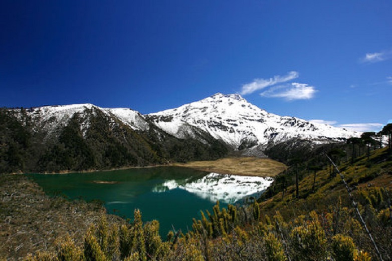
Today, tourists have a great opportunity to walk along one of the Inca Trails. Back in 1942, an expedition from Sweden opened a section of the road, which today has become the main tourist attraction. The journey along these trails will take 4 days. It starts from 3 mountain passes in the Andes, from the ruins of Inca architecture. From here, magnificent landscapes are wiped and you can contemplate the colossal snow-covered Andes.
Following this path, tourists walk 43 km along the railway. The starting point of the trip is Cusco, and the final point is Aguas Calientes. On the first day of adventure, tourists stop at Huallamba, on the second at Pacamayo, on the third at Huinau Huayna, and finally, on the fourth day, the stop will be at Machu Picchu.
Many note that the highlight of the hike is that after waking up at 3 am, hikers can see the sun rise over the mountains at their destination. The sun rises and slowly rises from the Gate of the Sun.
The best time to travel can be called the period May-September. This is the dry season and the best time to hike the Inca Trails.
The amazing landscapes of this area are breathtaking and make travelers come back here again and again.